


Drones
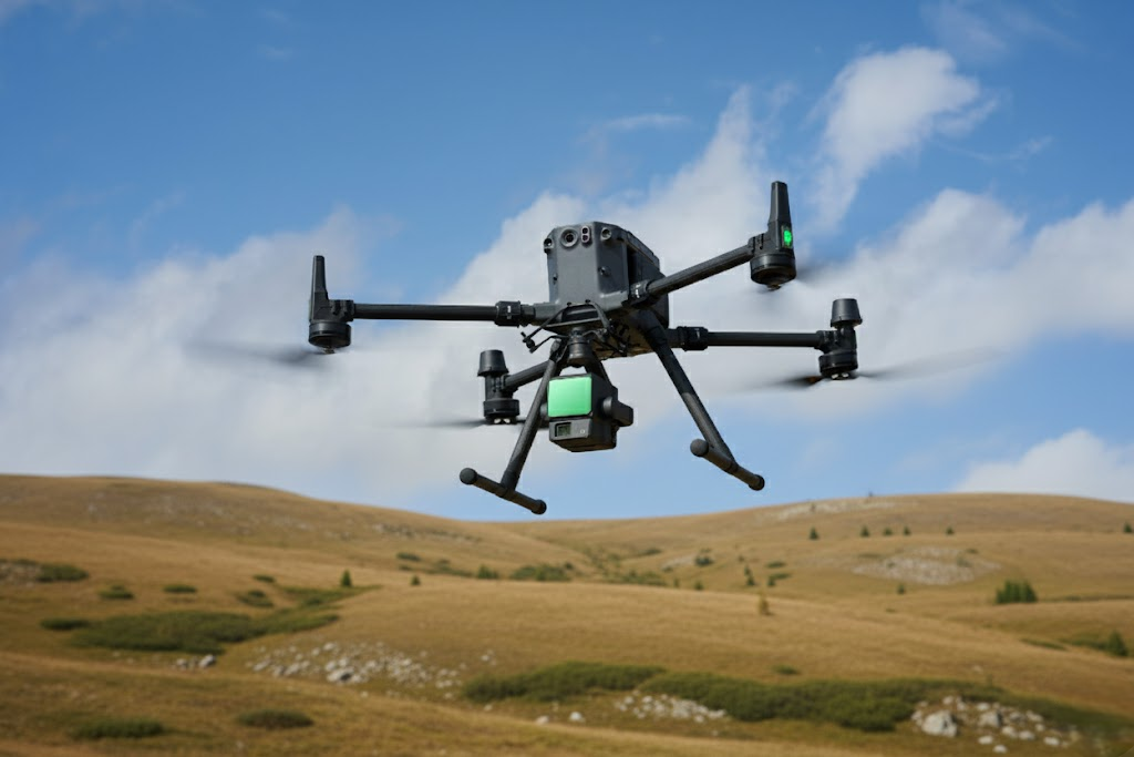
DJI Matrice 350 RTK + DJI L2 Camera
The benchmark for aerial mapping and surveying. Equipped with a built-in RTK system, the Matrice 350 RTK offers centimetric accuracy for your most demanding surveys.
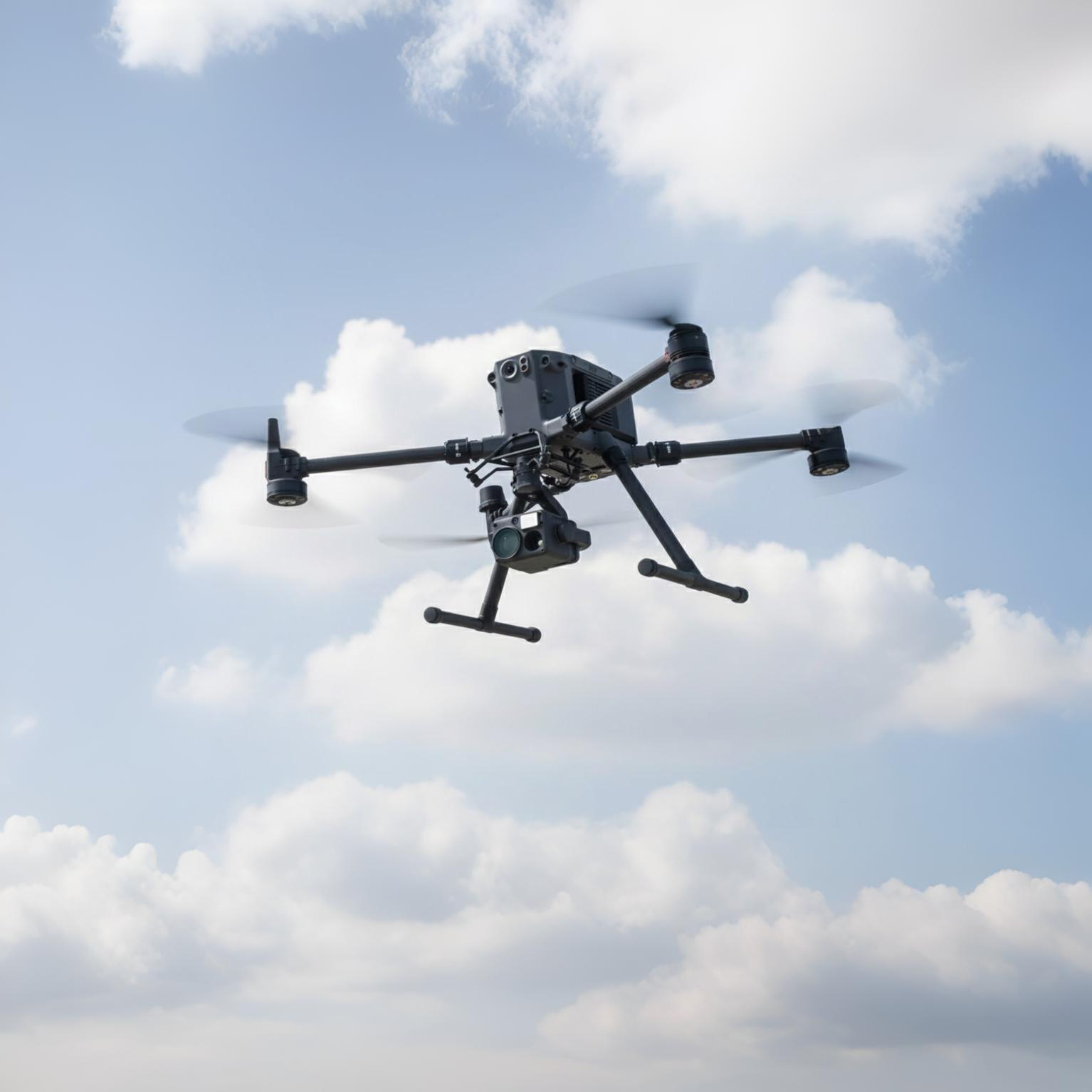
DJI Matrice 350 RTK + DJI H20T Camera
The benchmark for aerial mapping and surveying. Equipped with a built-in RTK system, the Matrice 350 RTK offers centimetric accuracy for your most demanding surveys.
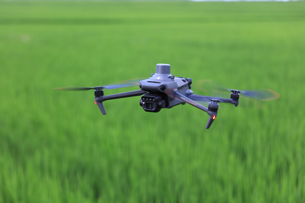
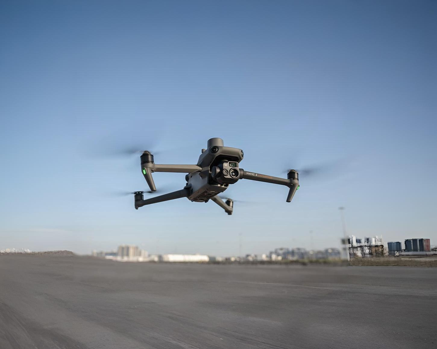
DJI Mavic M3M
The DJI Mavic 3E is designed for mapping and inspection missions with enhanced precision. Equipped with an RTK system for precise surveying, it enables detailed and reliable data collection in the field.
DJI Mavic M3E
Le DJI Mavic 3E est conçu pour la cartographie et l’inspection de haute précision. Grâce à son capteur grand angle optimisé pour la photogrammétrie et son obturateur mécanique, il garantit des relevés fiables, nets et exploitables, même à grande vitesse. Facile à déployer et ultra précis, c’est l’outil parfait pour les missions de topographie, de modélisation 3D et d’inspection technique où chaque détail compte.
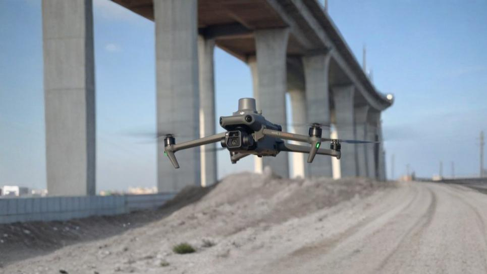
DJI Mavic M3T
The DJI Mavic 3T combines thermal and visual imaging capabilities for inspection and surveillance missions. With its enhanced precision and ease of use, it's ideal for fast, reliable surveys in a variety of environments.
Scanners
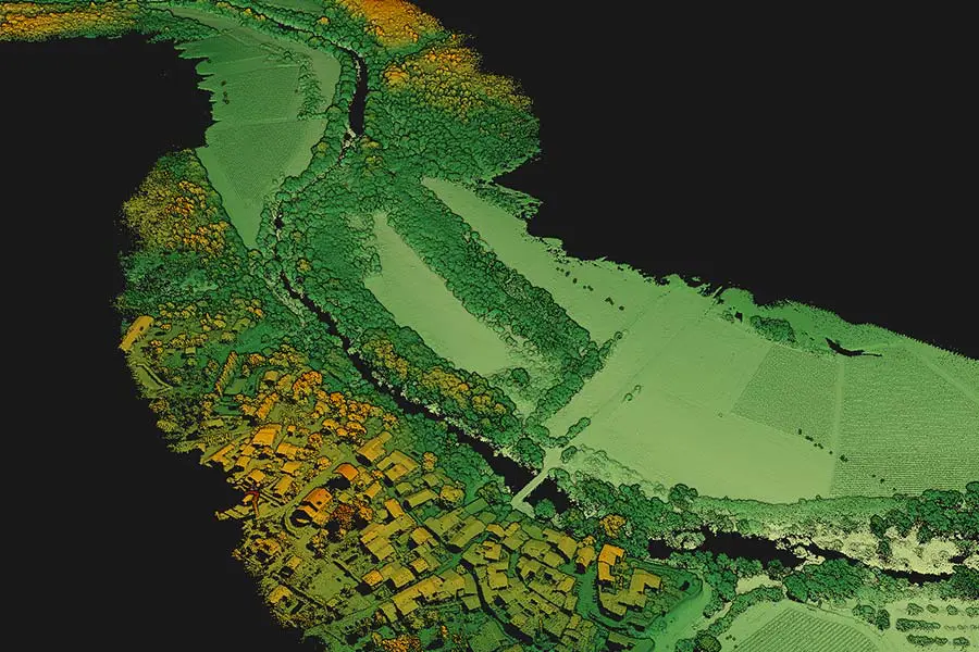
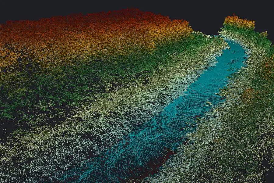
LIDAR DJI L2
The DJI L2 LIDAR offers fast, ultra-precise 3D data capture, enabling you to accurately map any type of environment. Thanks to its advanced technology, it combines reliability, efficiency and ease of use for your surveying, modeling or inspection projects.
.avif)
.avif)
BLK
The BLK is an ultra-precise, portable 3D laser scanner designed to quickly capture complex environments in exceptional detail. It combines ergonomics, reliability and cutting-edge technology, ideal for surveying, 3D modeling or architectural and industrial projects.
Trimble X9
The TRIMBLE X9 is a high-performance 3D laser scanner, combining speed, precision and advanced automation. It captures complex environments in exceptional detail, while optimizing workflow with its intelligent features. Ideal for surveying, construction, engineering and 3D modeling.

YellowScan Navigator
YellowScan Navigator est une solution LiDAR aéroportée longue portée et très haute densité, pensée pour les projets d’infrastructure, de corridors et de grands territoires. Puissant et précis, il offre une couverture étendue et des données exploitables même dans les environnements les plus exigeants.
YellowScan Voyager
YellowScan Voyager est un système LiDAR aéroporté léger et haute précision, conçu pour la cartographie topographique et bathymétrique de grande qualité. Il allie performance, fiabilité et rapidité de déploiement, idéal pour les missions de relevés complexes par drone.
Sensors
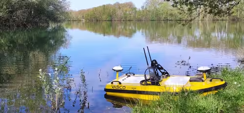
Bathydrone SUMO
The Bathydrone SUMO is a high-tech submersible drone designed to explore and map aquatic environments with exceptional precision. Robust, maneuverable and equipped with advanced sensors, it collects reliable data for research, inspection or hydrographic surveys, even in the most demanding conditions.
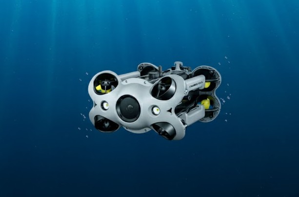
Deep Trekker Revolution
Deep Trekker Revolution est un ROV sous-marin professionnel robuste et polyvalent, conçu pour l’inspection, l’exploration et la maintenance en milieux aquatiques exigeants. Il offre une excellente stabilité, une grande maniabilité et des performances fiables pour les missions industrielles et techniques.
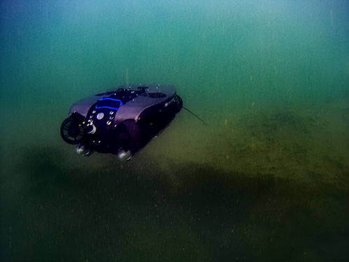
Fifish V6
Fifish V6 est un drone sous-marin compact et agile, pensé pour la capture d’images sous-marines de haute qualité et l’inspection visuelle rapide. Il combine mobilité à 360°, simplicité d’utilisation et technologie avancée, idéal pour les interventions efficaces en environnements confinés.
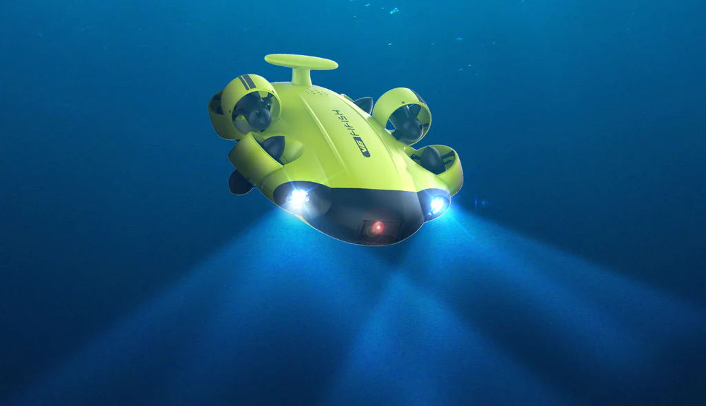
Chasing M2S
Chasing M2S est un drone sous-marin professionnel portable et puissant, conçu pour l’inspection, la recherche et la surveillance sous-marine. Précis et endurant, il s’adapte aux missions techniques tout en restant facile à déployer sur le terrain.
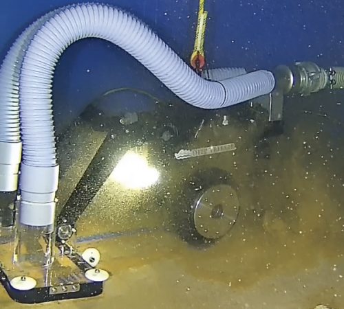
Robot DT 640 VAC
Robot DT 640 est un ROV sous-marin industriel haute capacité, développé pour les inspections lourdes et les interventions techniques complexes. Solide et performant, il est adapté aux environnements extrêmes et aux opérations professionnelles nécessitant fiabilité et précision.